Thursday, May 17, 2012

Mount Rainier: Gib Ledges to Fuhrer Finger.

The Fuhrer Finger, just left of the sunlit rocky ridge.
Exploring new routes on Mount Rainier is an exciting challenge.  This trip Matt and I were joined on our Cascade crusade by some friends from Tahoe, Corey Champage, Mike Carkill and Eric Seel who had never been on the peak.  They were psyched to say the least.

We wanted to get on the mountain and try to ski as soon as we could, but our weather window looked marginal.  We packed our bags, loaded Mike's truck and set off for Paradise.  We'd camp at Muir, climb and ski if we could the next day but probably have to wait another day for the wind to die.

Matt and the author scoping the ascent route.  Photo: Eric Seel.
Clouds filtered in and out as we made our way up the Muir Snowfield.  The temperatures were perfect for skinning, but we knew it was cold up top.


At Muir the temps were cold, but the scenery was amazing as usual.  We enjoyed a hot meal and went to bed realizing if the winds didn't drop we would be waiting another day.

Mount Adams from Camp Muir.  The Tatoosh range is capped by clouds in the foreground.  Photo: Eric Seel.

With cold temps and high winds we wouldn't need to get up early.  We woke up well after dawn and the wind was still howling.  


Shifting gears, we called off our climb to the upper mountain and instead went up to scout the route. 


Matt and Zeb checkin out the route.  Photo: Eric Seel.

Wind blowing snow off the top of Rainier as we scamper back from our scouting mission.


After inspecting the Gibraltar Chute and Ledges we decided that the icefall above the chute was way too active to climb that route.  The Ledges route was in fine shape and would allow us to move fast.  And since none of our team had climbed either route, we were happy to get on something new.
A small ice fall on the Nisqually Ice Cliff.

With another cold forecast, but lower winds from the Northwest, we set out the next morning fairly late.  10 is hardly an alpine start, but who needs that when temps on top are going to be -2 Fahrenheit and the wind will be 20 mph?


Corey and Zeb top out on the Col before the Ledges.  Photo: Eric Seel.

The start of the Gibraltar Ledges route.  Photo: Eric Seel.


Above the ledges, but below the top of Gibraltar. 

Corey, Matt and Seel climbing above Gib Rock.


On top with Mt Adams in the background.


Matt skis off the top.  Great firm, winter snow.
Corey celebrates a few sweet chalk turns.


Matt looks into a deep one.
The author makes a few turns on the Nisqually Glacier.

The author dropping into the clouds on the Fuhrer Finger. Photo: Eric Seel.

Skiing out the Wilson.  We reconnected with the Nisqually Glacier and skied all the way to the Nisqually Bridge at 3,900'.  10,500'+ descent, yeehaaa!


Tuesday, May 15, 2012

Mount Adams: Cascade Massive


Matt watches clouds clear on Mount Adams.
We knew this was going to be a big day.  We knew it was going to be literally longer than a marathon.  That it was going to be more vertical gain than Mount Rainier from Paradise or Mount Shasta from Bunny Flat.  But we didn't expect this 9,300' vertical, 35 mile round-trip journey to take us nearly 3 and a half hours longer than our 15 hour estimate.

It snowed on us as we started.


Taking the improving forecast into account, we started started our day relatively late: 3:00am.  Starting at the 3,000' Orr Creek Sno Park, we walked dirt road for the first mile.  When the snow became consistent we transitioned to skinning and picked up the pace a bit.  We skinned in nearly nine miles to the Killen Creek Trail junction.


Matt skins past lichen draped trees toward Killen Creek.

I expected to be relieved because we'd finally begin chipping away at the 9,281 we needed to get to the top.  I didn't think we'd be able to see any trail markers due to high snows, but I figured we'd be able to follow a rough outline of where the trail went.  This was not the case.  Instead all we found was thick woods and a maze of winding creeks.


The navigation was a nightmare. Every turn ended in a thick stand of trees, a steep bank of snow, or a creek.  We wandered our way through and by 10:00 we were at treeline around 6,000'.  Significantly farther from the top than we had hoped to be.

Matt skins toward the North Ridge.  Adams remains veiled in cloud.

Adams reveals itself...but it's still far away.
Seeing the mountain gave us new hope and we were able to pick up the pace.  It had taken us seven hours to gain the first 3,000'...a pathetic pace by climbing standards.  Even though our vertical rate was slow we were moving fast the whole time.  Now that we'd covered the approach we were ready to start getting some vert in.


The North Ridge of Mount Adams.  We skinned up the wind-drifted snow on the left, scrambled the scree and climbed the ridge.


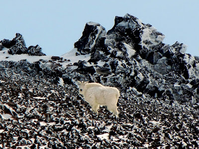
On the way up the scree leg of the ridge, we encountered another climber.  We kept our distance from the big white goat, having heard of their sometimes nasty tempers.  It was amazing to see the huge beast scramble up the rocks and disappear behind the ridge, but we were a little unnerved when he and his tracks disappeared in the scree and we couldn't tell where he'd gone.  I kept expecting him to charge suddenly around a corner and gore us.


Past the goat, we gained the ridge.  The climbing was all over the place.  It went from hard, wind-scoured alpine ice to knee-deep powder.  The variety and aesthetics of the line were amazing and made for an interesting climb.
Climbing one of the firm sections on the lower half of the ridge.

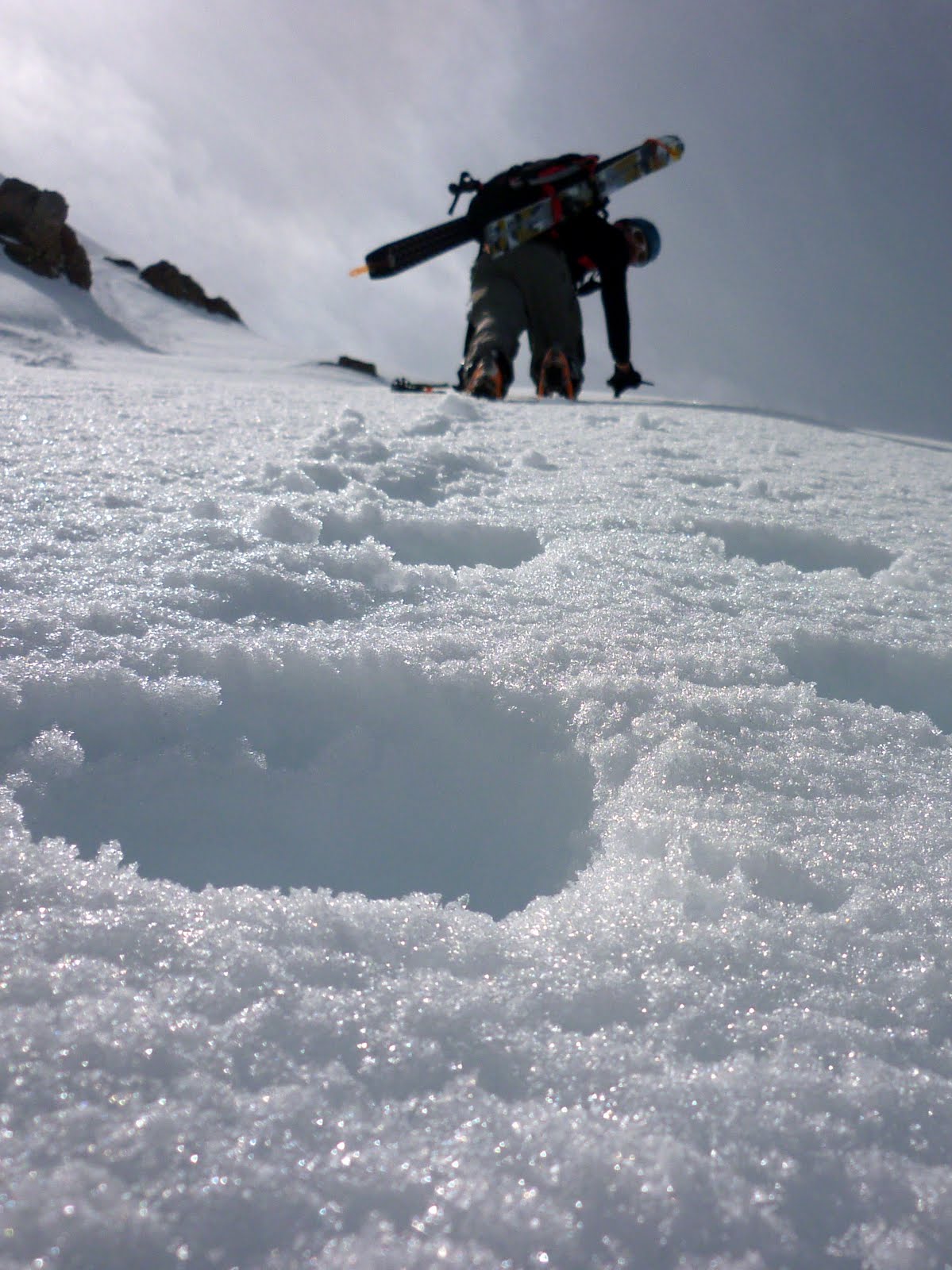
On top of the ridge the climbing quality took a dive.  Here the snow was heavily rimed and each step was like walking on a fragile coral reef.  Not fun.  The climbing continued this way for a long stretch to the false summit on top of the North Ridge and the extra third of a mile to the true summit.

Matt walking the rime reef.

After slogging to the summit, we skied down the chicken head packed slope to the col between the summit and The Pinnacle, the top of the Northwest Ridge.
 From there we had to transition again from skis back to crampons and we made the uphill traverse to reach The Pinnacle.

Matt traverses The Pinnacle.
Down climbing before it got good.

All the effort payed off.   After a short down climb and a few nasty rimed kick turns we got into the goods of the North Face of the Northwest Ridge.  The skiing here was some of the best turns of the trip.  The powder was settled and stable, although we skied our first few turns with caution after seeing a large debris pile that had plowed out of the Adams Glacier just to our east.

Matt gets the goods on the North Face of the NW Ridge.
The skiing was perfect powder.  Huge relief, nearly 3,000' of great snow and somewhere around 40 degree turns.  It was amazing!

The author slashing one.
As good as the skiing was, we were relieved when we were off the glacier and back onto terra-firma.  We'd made it past the technical and dangerous parts of the tour and just had to crank out the remaining 12 miles between us and our car.

Success! Our ski line is on the far right of the picture, mostly out of view.


Tuesday, May 1, 2012

Mount Hood: the PNW gets weirder

A strange tree in the Pacific Northwest. Photo: Matt Paul.
The Pacific Northwest gets stranger by the minute.  Or maybe just stays stranger by the minute.  The forecast for 4/29 didn't look remotely good for climbing a decent sized mountain like 11,249' Mount Hood.  My experience in the Northwest has led me to believe that usually the weather is worse than the forecast lets on.  Taking these things into account we made our trip plan for Hood thinking the snow would be microwaved slop, kept soggy by heat trapped in the clouds all day.  We figured we might as well sleep in a bit, catch up on some zzz's, have a civilized cup of coffee then punch out 7,000' vert on Hood and ski down.  Good plan, till we got to Hood River.

When we arrived the sky went blue-bird.  We were psyched, but we realized that we might have blown our timing for getting decent snow quality.

Just a puff of cloud on the summit of Mount Hood.


We knew we would have to make haste to get our skis on the snow before it all turned to mush.   But as soon as we reached the trail head we hit a stumbling block: there was no snow at the trail-head. We plowed through a few hundred vert on dirt trails.

"I like walking on dirt in ski boots!"
As soon as we hit consistent snow, we picked up the pace.  Glimpses of Hood peered through the burned out forest as we gained the ridge heading toward the Cooper Spur, our chosen climbing route.

The torched forest was beautiful in a strange PNW sort of way.
Above treeline, the Spur jutted into our faces.  Behind it the steep north face of Mount Hood rises above the Eliot Glacier.

Slogging up the snowfield toward the Cooper Spur.

The Cooper Spur points directly to Hood's summit.
 We traversed the ridge and went straight up.  We soon realized we didn't need to rush.  The snow was rock hard for the last 1,000' to the summit and it wasn't softening soon.  This made for great climbing conditions, but but the skiing left something to be desired.


Ascending the steepest part of the climb about 500' from the top.
This part was pretty steep too...
 The snow was steep and firm enough that we decided against skiing the upper 1,000' or so.  Around 10,000' I side-slipped until it became somewhat edge-able.  Good times...

Matt down climbing some steep, hard "snow".


You can almost hear how sweet the skiing is in this picture...it sounds like the ocean.
Off the steeps there were some great wind buffed turns.  It was nice to be able to snap a few fun turns in.

Matt Paul cranks some soft chalk.


Another fun turn.
On the Eliot there were even a few good corn turns.  I love how snow changes.

Fun turns were all over the Elliot Glacier and below.

Every good ski tour ends with a nice walk in the woods.


Mount Saint Helens: in the PNW get above the clouds ~ ~ ~


The Mount Saint Helens White Room.
We were treating this as a training trip.  The weather was supposed to be miserable.  And it started out just as it was supposed to: gray, gloomy and moist.

Matt Paul avoiding a large hole in the Worm Flow moraines.
But, as it happens in the Pacific Northwest, if you don't like the weather you have to change your altitude.  As we got higher on the mountain we out-climbed the clouds and broke though the cloud ceiling that was thick everywhere below 5,000'.

Perseverance paid off and the clouds cleared just above 5,000'.

Above the cloud the unfiltered sun bore down on us.  It's been two days since we did this climb and my thighs are still burning from opening my ski pant vents and not sun-screening my legs.  We climbed fast and made the most of the good weather.

Matt churning up the Monitor Ridge towards the crater rim of Mount Saint Helens.


Matt taking a breather at 8,000'.


Me standing on the Crater Rim.  The true summit is the far peak in the background with the HUGE cornice.  Photo: Matt Paul.

Matt at the crater's edge.

Me on the rim of the smoking caldera.  This is a must see!  Even if the skiing is awful, the views make the trip well worthwhile.  Photo: Matt Paul.

Me peering into the center of St Helen's Crater Rim.  Photo: Matt Paul.

Me standing on the true summit of Mount Saint Helens.  HUGE cornice.  Photo: Matt Paul.
The snow was much stickier than expected, but there were a few good turns to be had above 6,000'. Below that and it was survival skiing.  The transitioning snow varied between velcro and glue and it was a struggle not to have a leg ripped off.  But heh, skiing's always better than walking right?

Matt descends a rib of Monitor Ridge with Mount Adams jutting above the clouds.
What goes up must come down.  So we set off into the clouds back to the trail head.  The only way to keep glide was to ski on skin tracks and  the snowshoes packed trail.  We kept a few snow-shoers on their toes on the way down.

The skiing below 6,000' wasn't amazing, but Matt made it look alright.

Descending below the cloud deck on volcanic moraines.